Skip to content
EUSAR (oral)Published2026

ZeroFlood: Flood Hazard Mapping from Single-Modality SAR Using Geo-Foundation Models

Authors: H. Kim, O. Oikonomou
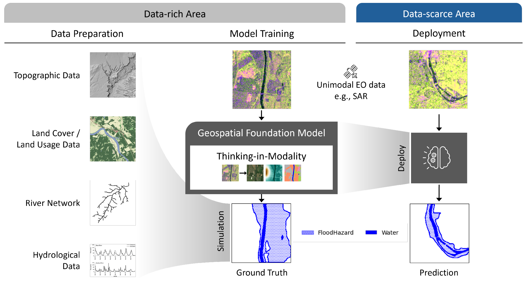
ZeroFlood workflow: geophysical data and flood simulations train a geospatial foundation model, deployed with SAR imagery in data-scarce regions.
Figure 1 · ZeroFlood framework. Kim & Oikonomou.Source paper ↗CC BY 4.0Page cropped; converted to WebP. Diagram unchanged.

Figure detail

Open original ↗
ZeroFlood workflow: geophysical data and flood simulations train a geospatial foundation model, deployed with SAR imagery in data-scarce regions.

Figure 1 · ZeroFlood framework. Kim & Oikonomou.

Page cropped; converted to WebP. Diagram unchanged.

Research summary

ZeroFlood uses geospatial foundation models to map flood hazards from SAR imagery. It evaluates transfer from simulated European flood data to regions with limited observations.

Research topics

  • Geospatial foundation models
  • Remote sensing
  • SAR
  • Flood hazard mapping

Research portfolio of Orestis Oikonomou.